map
Folders and files
| Name | Name | Last commit date | ||
|---|---|---|---|---|
parent directory.. | ||||
# BART System Map An open source BART system map I designed in 2012 for developers who want to include a simple BART map in their applications. # Changelog 2017-09-02 (current) 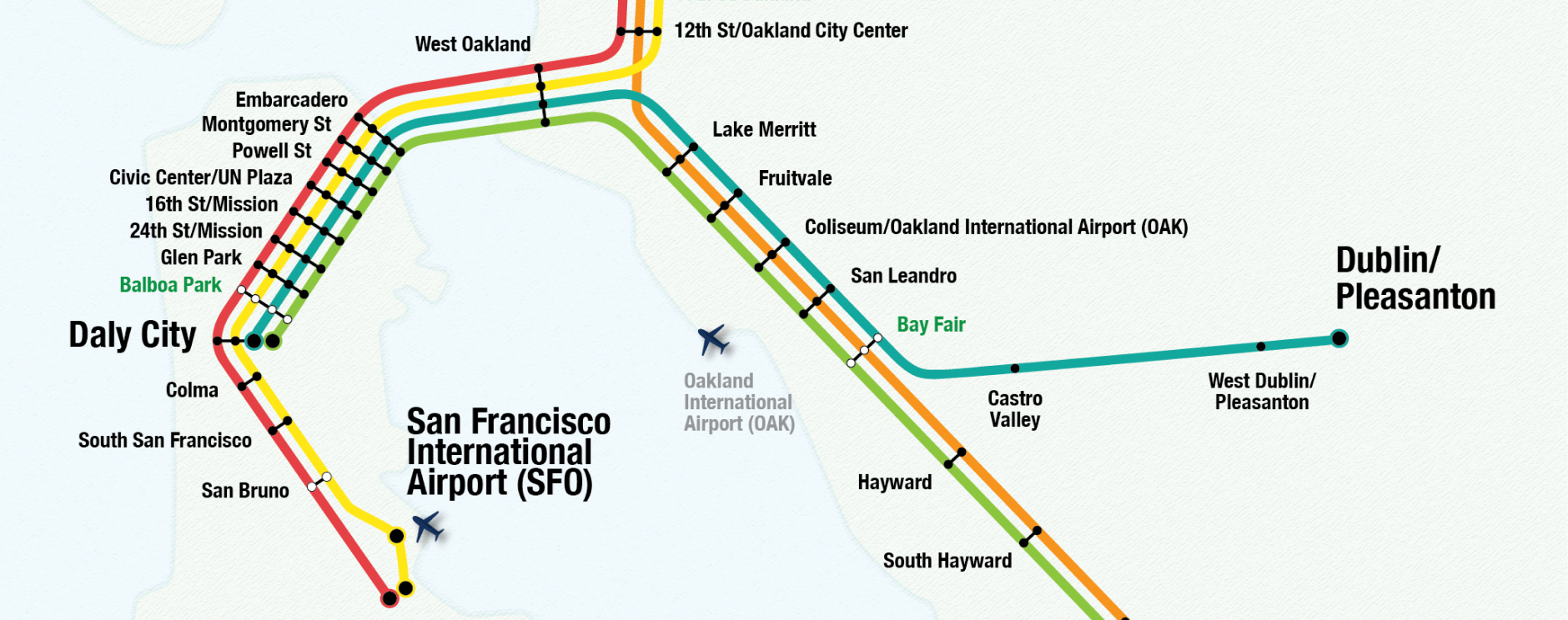 * Added Warm Springs/South Fremont station * Removed reference to AirBART bus service, as it's been discontinued * Edited a few station names * Cleaned up the legend * Reduced width of map * Reduced opacity of base map from 40% to 25% * Reduced stroke from 3 pt to 1 pt on transfer stations 2012-04-25  * First version of map ## Source The 'app map' is available on [github](https://github.com/trucy/bart-map) and [BART's website](http://www.bart.gov/schedules/developers/maps.aspx) in AI and .png formats. ## Example Use the AI file to change the base map, line colors and widths, fonts, etc.  ## Contributing Pull requests with updates are welcome. ## Projects using this map * [BART App](https://play.google.com/store/apps/details?id=com.bartapp) * [BART Runner](https://play.google.com/store/apps/details?id=com.dougkeen.bart&rdid=com.dougkeen.bart) * [BART Smiling Ride](https://play.google.com/store/apps/details?id=com.mobispectra.android.apps.srbart) * [BikeHub](http://bikehub.com/bartbikestation/) * [Citymapper](https://citymapper.com/sf-bay-area/) * [Easy BART](https://itunes.apple.com/us/app/easy-bart/id567074135) * [WikiHow](http://www.wikihow.com/Ride-Bay-Area-Rapid-Transit-(BART)) Did you do something cool with this map or use it in your app? Email me at [email protected] and I'll add it to the list. ## Author Trucy Phan ## License and copyright This work is licensed under a Creative Commons Attribution 3.0 Unported License.